|
[Trail Log]
Stuff - GPS files; pictures; gear tips. Read about it here.
Day 0 - Traveling to Hilo; getting hiking passes; getting supplies; being bored. Read about it here.
Day 1 - Driving to the trail head; hiking to Red Hill cabin. Read about it here.
Day 2 - From Red Hill cabin to the summit cabin. Read about it here.
Day 3 - From the summit cabin to the actual summit; back down to Red Hill cabin. Read about it here.
Day 4 - From Red Hill cabin back to trail head. Read about it here.
[Day 1 - October 01, 2006]
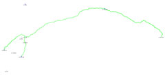
Day one involed getting an early start, checking out of the hotel, driving to the trail-head and hiking roughly eight miles to Red Hill cabin. The hike will take you from 6,600 feet to a little over 10,000. You definitely don't need an early start for this relatively short hike, unless you're anticipating slow progress. It is steep ... but hardly worth mentioning. Check out the map for an idea of this first day's hike.
[Daylight]
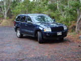
Daylight this time of year is rather scarce - roughly twelve hours of sunlight are available starting at 06.00. Six to six in other words. Melissa and I had packed everything the night before, so it was just a matter of getting dressed, hauling everything down to the Jeep, and driving off. It takes about an hour and a half to get from the Hilo Hawaiian Hotel to the Mauna Loa trail head. Prior to leaving for the vacation I used Google Earth and located the hotel, the park headquarters, the mauna loa trail road, and the trail head. Once in Hilo finding these places turned out to be remarkably easy (they don't have very many roads), but having them in the GPS was nice anyway.
[Starting the Hike]
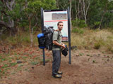
We started the hike a little after 07.00. The rangers say that it'll take between 4 and 6 hours to reach Red Hill cabin. Obviously one's speed is going to dictated by one's level of fitness and the weight of one's pack (which is largely a factor of the amount of water needed). More on water, later. Four hours is pretty reasonable if you're in good shape and only need to carry one day's worth of water with you. A good way to make it take six+ hours is to bring along a slow friend. :-) But this is the shortest segment of the hike, so speed isn't really an issue if you get an early start.
On the way up we passed two couples on their way down. The first couple had been at Red Hill the night before. They indicated that there was plenty of water to be had. The second couple - older people - looked as though they had camped out under a tree. From our brief conversation I gathered that they had not made it to Red Hill, and that they were on their way down. This was no more than an hour into the hike, so they really gave up early. I didn't inquire any further. It's a good thing that they didn't try to summit.
[The Trail]
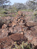
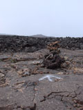
The "trail" (as it is called) is marked by piles of rocks. This seems like a remarkably poor idea since the entire volcano is covered in piles of rocks. With some effort one can learn to distinguish between natural piles and man-made piles. Some are more obvious than others. At points the trail is worn into the ground enough that these rock piles are unnecessary. Still, it is a welcome relief to find a large pile of rocks - such that you can know that you're going the right way. The terrain for the first day isn't too bad. It's grade is the worst part of it. The ground is relatively stable. This picture is of one of the first rock piles. At the time it seemed worth photographing. After seeing several hundred of them, they seem less significant.
[The Fence]
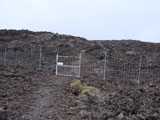
Perhaps the weirdest thing to behold on this segment of the hike is the fence and the two gates. If wild horses or cows roamed the lava fields of Mauna Loa, its presence would make more sense to me. However, since I didn't see a single mammal or reptile the entire time, and considering the effort that went into installing this enormous length of fence, I don't know what to think. Crazy stuff.
[Crazy Weather]
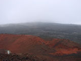
The rangers will probably warn you that a nice warm day can turn into a cold rainy day very quickly. This happened both days on the way up. The first day it was cool and over-cast the entire time. A slightly mist was present which felt great. For the last hour, however, it was raining pretty hard. Melissa started getting a bit aggitated by the dark and dreary terrain when accompanied by the cold rain. It can seem a bit depressing when you've seen Red Hill far off in the distance, you're finally *there*, but the cabin is never "just around the bend".
[Red Hill Cabin]
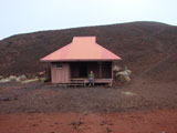
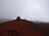
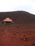
Red Hill cabin is quite un-remarkably located amongst some red hills. In between two of them, more specifically. The segment of the trail near the end seemingly endlessly circles and ascends Red Hill. Our pace suffered. Melissa's pace suffered, rather. After a while I scurried on up to the top, dropped off my pack and jogged back down to find Melissa and took her pack. Un-surprisingly, this brightened her demeanor a bit.
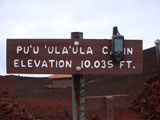
Red Hill cabin is supposedly some 10,035 feet above sea-level. All of the thousand-foot markers I came across were quite accurate, but this one was way off. Or my GPS was suddenly way off. Specifically, my GPS was distinctly under the impression that the 10,035 foot sign was in fact at 10,131. The cabin is certainly lower than the sign, but not by ~100 feet. Also, you can see that the "real" name of the cabin is the entirely un-pronouncable Pu'u 'ula'ula cabin. Maybe the guy was dictating and starting vomitting. I can see that.
[Altitude Sickness]
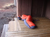
Altitude sickness is very likely on this hike, although perhaps not so likely for the first day - unless you've lived at or near sea-level your entire life. I don't know if there are any residual effects from my having lived at 7,200 feet for quite a few years, but I experienced almost no symptoms. The worst ailment for the first day was a sunburn on the back of my neck. Anyway, not everyone acclimates to altitude the same. For instance, I decided to explore the area, climb Red Hill, call home and cook some food. Melissa decided to take a bunch of drugs and curl up in her sleeping back on the front porch of the cabin.
[Water]
Water is obviously an important topic. Everything I read on the matter indicated that three to four liters per day (per person) was a safe minimum. Of course "safe" when referring to hiking an active volcano allows for some flexibility.
Water is potentially available at both the Red Hill cabin and the Summit cabin. The metal roofs slope down to gutters which channel the water into a tank - with a spigot at the bottom. Apparently this time of year is the rainy season, and as such there was roughly a swimming pool available. You should be able to find out from the rangers, before starting the hike, how much water is available. With this in mind, you can figure out how much water you need to bring. Potentially, if no water is available at either location, you'll need to bring enough water for all four days. Have fun with that.
If it is getting very cold at night, it is a good idea to get your water before turning in for the night - in case it is all frozen the following morning. If there is substantial water, it is unlikely that it'll freeze all the way down to the bottom (from which the spigot gets the water), but why risk it?
For the first day I carried roughly four liters. During the course of the hike I consumed exactly two liters. And during each subsequent day I only consumed two liters (during the actual hike). Upon reaching the cabin I drank some additional water, used some more water for tea and a freeze-dried meal. Hiking conditions were rather ideal (cool and over-cast), so profuse sweating was not taking place. I could see how a gallon would be necessary during a hot day, although as one ascends, the chances of becoming hot definitely drop.
[Facilities]
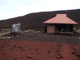
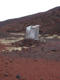
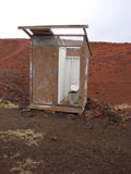
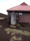
Red Hill cabin offers two toilets. It appears that they each used to have a door, although one of them is now missing. The stall with a door features a whole toilet seat, though, so that's nice. It's a bit cramped. I brought bio-degradable toilet paper with me, however there was some available in the stall. I wouldn't depend on that, however - there isn't exactly a lot of foliage present. The grass around the toilets seems to be prospering, oddly enough. :-) Let's just so that it is probably well fed.
[Cell Phone Service]
I left my (T-Mobile) phone in the car back at the trail head, while Melissa brought her (Cingular) phone (Blackberry) with her. I had read that cell phone service was available from Red Hill, and I was eager to verify it. We arrived at Red Hill around 14.00 (Hawaii time) which was early enough to call friends back in Atlanta (20.00 Eastern time), and so I did. Of course, there is no service in the cabin itself, since it is safely located in a recessed area surrounded by hills, but if you climb up the trail behind the cabin to the top of Red Hill, you can get a strong signal. And we did. It was a bit pointless trying to describe the amazing view while talking on the phone. I tried just the same.
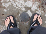
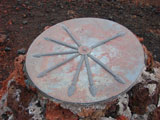
Additionally, a couple odd things can be found at the top of Red Hill. First, there's a large metal plate on a mound of rocks with arrows pointing to what appear to be very boring locations - not the least of which is Hilo. And then there's some sort of USGS (?) marker. Despite having a picture of it, I have lacked the motivation to read the text as it circles around the stupid marker. It probably indicates exactly what it is. While reading it, you can also take the opportunity to admire my incredible feet. Since this was only the first day, they remained blister-free. One day I hope my feet look like that again.
|